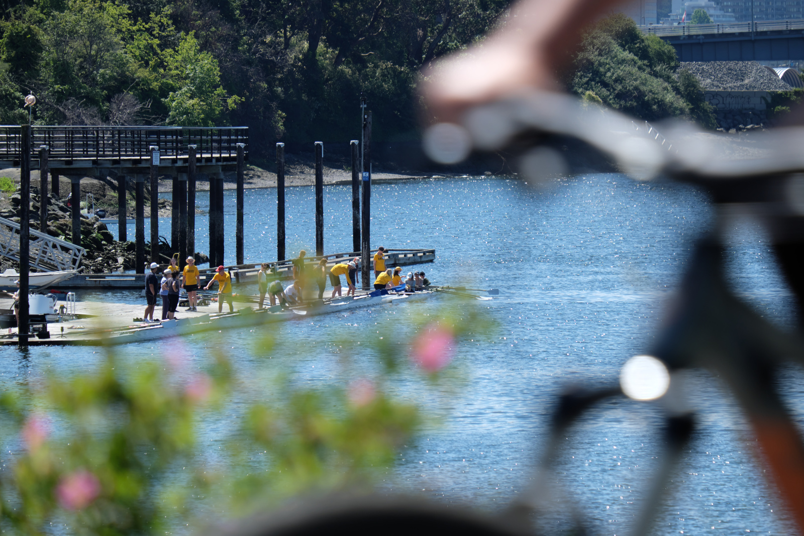
Bike and Roll Routes To The Club
The City of Victoria has an excellent network of safe bike & roll routes that makes using a bike, trike, or mobility scooter a safe and effective way to get to Gorge Narrows Rowing Club.
The club is fortunate to be on two major All Ages and Abilities (AAA) routes, the Galloping Goose Regional Trail, and Gorge Road.
These two routes connect to others, and make it easy and safe to get to the club from Saanich, Esquimalt, Vic West, Downtown, and pretty much anywhere in the City of Victoria.
Parking Your Bike
Here are a few things you should know:
- There's a lot of bike parking withing a few meters of the club!
- Please do not ask to bring your bike into the boathouse. We need all of the space to carry boats in and out!
- Many people are concerned about their bike getting stolen. We are fortunate that this is a busy area most of the day, and appropriately locked bikes are generally safe.
- As a reminder, no matter where you are, always secure your bike with a U-lock, a heavy folding lock, or a heavy chain. Cable locks can be cut in seconds with a simple hand tool and should never be used as your primary lock.
Planning Your Trip
The route you'll find best depends a lot on your individual preferences. Some people are comfortable riding in traffic. Other people will ride in traffic for short stretches. And many prefer to stick to quiet streets and protected bike lanes. There's no right or wrong way to choose.
Here are some tools that many people find useful. Unfortunately, none of them are perfect.
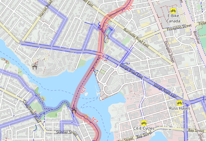
- The City of Victoria's map of all cycling facilities is a static map that shows the different types of bike lanes in the city. These include AAA protected lanes (like Gorge Road) and multi-use pathways (like the Galloping Goose), along with AAA shared-use streets, and painted bike lanes. The AAA network is the gold standard for comfortable cycling. The map is most often useful as a sanity check on the routes generated by tools like OpenStreetMaps and Google Maps.
- Google Maps can provide cycling directions and has an excellent, intuitive, interface and is amazing at finding locations. Unfortunately, Google Maps sometimes generates cycling routes that are really bad. Still, it runs on everything and has an excellent user interface, and it's easy to modify the routes it generates. For example, with the web interface it's easy to drag the route onto a AAA lane if one wants a more comfortable route.
- OpenStreetMap is an open source mapping project that has multiple web, Android and iPhone apps. On the web, OpenRouteService has solid features and is being used on this page. On Android, at least, the most widely used app is OsmAnd. Because OpenStreetMap is open source the routes tend to be updated a lot more frequently than Google Maps, and there are different layers that are dedicated to cycling. For example, the previous link uses the CycleOSM layer, which highlights and colour codes different types of bike & roll routes.
- Another useful tool is BRouter, which has a web interface and a plug-in for OSMAnd on Android phones. BRouter supports multiple routing profiles, and it's Safety profile, while not perfect, makes good use of safe cycling infrastructure. Configuring BRouter as an OSMAnd plugin requires extra steps and is definitely not as simple as some of the other options.
Some Key Choices
If you're coming from Esquimalt or Vic West on the E&N, your main choice is whether to continue all the way to the Johnson Street Bridge, then take Harbour Road to the Goose and go across at the Selkirk Trestle, or to make your way to Pine Street and cut through Banfield Park. Cutting through the park is obviously shorter, but, time wise, the difference is less that you might think, and the longer route is entirely on separated infrastructure.
If you're east or south of Downtown, then the easiest route is generally to take the Johnson Street Bridge to Harbour Road, the Goose, and the trestle. Wharf, Blanshard, and Vancouver are all good ways to get to Pandora, which will then take you to the bridge.
If you're north of Pandora, you can either go to Pandora and across the bridge (as above), or take the separated bike lanes on Government to Gorge Road East, then turn into Selkirk Village at Jutland. Pandora and Caledonia are both good ways to get to Government (although if you're on Pandora you might as well continue across the bridge). If you're even farther north, you can take Kings to Hillside to Gorge Road East.
If you're farther east, then taking Haultain to Kings is an option.
From Saanich, it's often easy to get to the Galloping Goose or the Lochside Regional Trail (which connect with the Goose near Uptown Mall).
From further west in Saanich, Tillicum Road has protected lanes, but there's a gap in Gorge Road West's bike lanes between Tillicum and Harriet. Maddock Ave and Balfour Ave are reasonable streets to ride on, so Maddock to Balfour to Gorge Road E makes a decent route.
From Reynolds Secondary School
About 15 minutes. Take the Lockside Regional Trail and continue onto the Galloping Goose.
From Esquimalt High School
From Victoria High School
There are several good routes:
- About 12 minutes. Caledonia to Government to Gorge Road East.
- About 18 minutes. Caledonia to Government to Pandora and across the JSB to the trestle.
- About 17 minutes. North Park to Vancouver to Pandora and across the JSB to the trestle.
From Oak Bay High School
There are several good routes:
- About 19 minutes. Haultain, Kings, and Gorge Road East.
- About 25 minutes. Cadboro Bay Road to Fort to Wharf to the JSB, Harbour, and the Goose.